
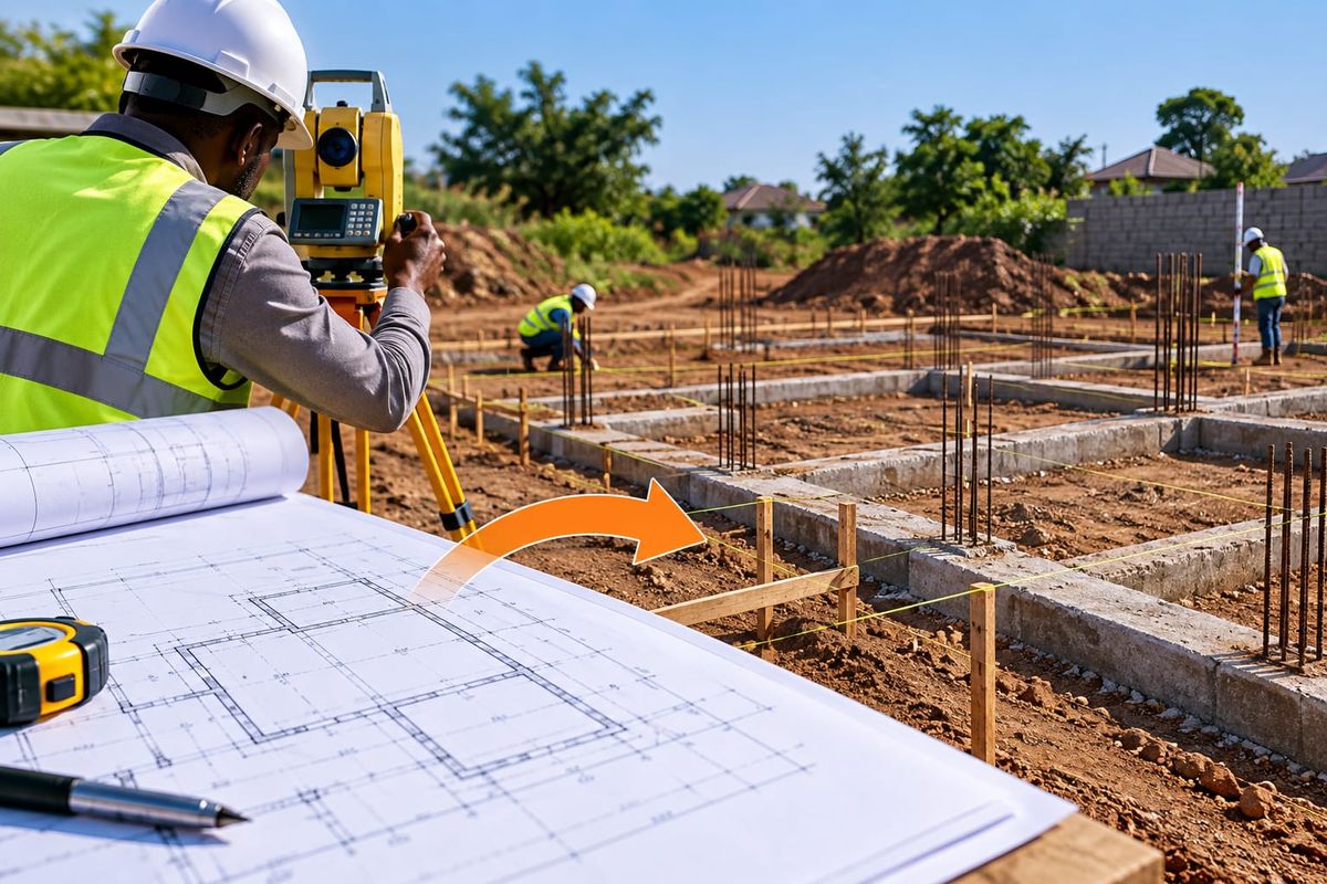
Construction Setting Out Explained: How Surveyors Turn Drawings into Real Foundations

Apex Surveyors Team
An architect draws a building on paper. The engineer checks the numbers. The contractor is ready to dig.
But there's one question that has to be answered before the first bucket of soil moves: where exactly does this building go?
That's what construction setting out answers. It's the step where a surveyor takes the dimensions on a drawing and marks them on the ground, so the foundation, columns and walls end up precisely where the designers intended. Get it right and the project runs smoothly. Get it wrong and every trade that follows inherits the mistake.
This guide explains setting out in plain language, so you know what to expect whether you're a homeowner, developer, contractor or project manager building in Juba.
What Is Construction Setting Out?
Setting out (also called staking out or building layout) is the reverse of a normal survey.
In a topographic survey, a surveyor measures what already exists on the ground and turns it into a drawing. In setting out, the surveyor starts with the drawing and turns it into physical marks on the ground: pegs, nails, paint marks and reference lines that tell the builders where to dig and build.
Those marks show things like:
- The corners of the building
- The centre lines of walls and columns
- The edges of footings and trenches
- The heights (levels) for excavation, foundations and floor slabs
- The position of roads, drains, fences and services around the building
Think of it as translating the design into a language the site crew can act on.
Why Setting Out Matters So Much
Foundations are the one part of a building you can't easily fix later. A wall that's a few centimetres off can be corrected with plaster. A foundation that's in the wrong place, or at the wrong level, is a different story.
Here's what setting out mistakes can cause:
- Buildings that sit too close to a boundary, or even cross it, leading to disputes with neighbours.
- Walls and columns that don't line up with the structural design, which affects strength.
- Floors at the wrong height, causing drainage problems, flooding or awkward steps.
- Costly rework, such as breaking out concrete that's already been poured.
- Delays, because other trades can't proceed until the error is resolved.
A small error in the first week can become a major expense in the third month. That's why experienced contractors treat setting out as insurance, not as an optional extra.
What a Surveyor Needs Before Starting
Good setting out depends on good information. Before a surveyor comes to site, they usually need:
1. Approved drawings. Architectural and structural plans showing dimensions, gridlines, levels and the building's position on the plot.
2. Site boundaries. The surveyor needs to know where the plot legally ends so the building sits inside it. If boundaries are unclear, a boundary survey should come first.
3. Existing site data. A topographic survey shows the natural ground levels, slopes and features, which helps plan excavation and drainage.
4. Control points. Fixed reference points with known coordinates and heights, which act as the foundation for all measurements on site.
5. The latest drawing revisions. Working from an outdated drawing is one of the easiest ways to set out the wrong thing perfectly.
How Setting Out Works, Step by Step
Every project is different, but a typical building setting out follows this flow.
Step 1: Check the drawings
The surveyor reviews the plans and looks for conflicts, missing dimensions or details that don't agree between architectural and structural drawings. Catching a mismatch on paper costs nothing. Catching it after concrete is poured costs a lot.
Step 2: Establish site control
The surveyor sets up reliable reference points on or near the site, using GNSS equipment and total stations. These points are placed where they won't be disturbed by excavation or traffic, because everything else is measured from them.
Step 3: Mark the building corners and gridlines
Using the control points, the surveyor calculates the coordinates of each corner and gridline, then places pegs or marks on the ground at those locations. This is the moment the building footprint first appears on site.
Step 4: Set up offset pegs or profile boards
Corner pegs get destroyed the moment excavation starts. So surveyors place reference marks, called offsets, a safe distance outside the work area. Builders can then use these to re-find the exact positions of walls and footings as digging progresses. You'll often see timber profile boards with strings stretched between them for this purpose.
Step 5: Transfer levels
Setting out isn't only about horizontal position. The surveyor also establishes a site benchmark and transfers heights to control excavation depth, foundation levels and the finished floor level. Getting the floor level right early makes drainage, steps and access work properly later.
Step 6: Check as work progresses
A good surveyor doesn't set out once and disappear. They return to verify trenches before concrete, check column positions after formwork, and confirm levels at each stage. These checks catch small deviations before they turn into big ones.
Step 7: Record what was built
At the end, an as-built survey confirms that the finished work matches the design, and documents any differences. This gives owners and engineers reliable records for handover. Read more in our post on why as-built, existing and final surveys keep projects accountable.
The Tools Surveyors Use
Modern setting out relies on precise equipment:
- Total stations measure angles and distances electronically and are the standard tool for marking building corners and gridlines accurately.
- GNSS RTK receivers use satellite positioning with live corrections to set out points across larger sites quickly, especially for roads, fences and site boundaries.
- Digital and dumpy levels control heights for excavation, foundations and floors.
- Laser levels help builders keep slabs and formwork level once the surveyor has set the benchmark.
- Tapes, plumb bobs and string lines still have their place for quick checks by the site team.
Which tool is used depends on the job. Small house foundations may need only a total station and a level, while a large development may combine GNSS control with total station work on the buildings themselves.
If your team handles some of its own site checking, our equipment catalog includes survey instruments, and you can read about leasing versus buying survey equipment if you only need it for one project.
Setting Out for Foundations Specifically
Foundations deserve their own attention, because everything above them depends on getting them right. For foundation work, surveyors typically:
- Mark trench lines or pad positions for footings
- Set excavation depths using a controlled benchmark
- Confirm column positions and centre lines
- Check that footings, starter bars and ground beams are in the correct place before concrete is poured
- Verify levels for the ground slab or floor
The point is simple: verify before you pour. Concrete can't be moved, so checks happen first.
Our Foundation Bases and Engineering Surveying services are built around exactly this process.
Common Setting Out Mistakes (and How to Avoid Them)
Using outdated drawings. Always confirm the surveyor and the contractor are working from the same, latest revision.
Skipping site control. Setting out from a single peg, or from a fence or an old building, invites errors. Proper control points protect accuracy across the whole site.
Losing the pegs. Heavy rain, machinery and busy crews can destroy markers. Protect them, and make sure offset marks are in place.
Not checking the work as it progresses. One setting out visit at the start isn't enough for most projects. Build checkpoints into the schedule.
Ignoring boundaries. Assuming you know where the plot ends is risky. Confirm the boundary first, especially near neighbours or roads.
Getting levels wrong. A misjudged benchmark leads to floors at the wrong height and drainage that doesn't work. Set and protect one clear site benchmark.
Leaving the surveyor out of the loop. Design changes on site need to be passed to the surveyor before anything is marked or built.
Do I Need a Surveyor for a Small House?
Short answer: yes, it's worth it.
It's tempting to use tape measures and string lines on a small residential project, and skilled builders can do decent work that way. But the risks are the same as on a large project: a wrong boundary distance, out-of-square corners or an incorrect floor level. A professional setting out is a small cost compared with the expense of correcting a foundation.
For bigger projects, such as commercial buildings, apartment blocks, warehouses and compounds, it isn't optional.
Setting Out and Site Conditions in Juba
Every location brings its own challenges. On projects in Juba, it's worth planning for:
- Rainy season disruption, which can wash away or shift pegs and make access difficult. Schedule checks after heavy rain.
- Site access and security, so markers aren't moved or removed.
- Changing site levels, as clearing, filling and grading alter the ground before and during construction.
- Coordination between teams, since architects, engineers and contractors may be working from different information.
A local team that knows these conditions can plan the work around them.
Frequently Asked Questions
What is the difference between a topographic survey and setting out?
A topographic survey measures the existing site and produces a map. Setting out takes the design drawings and marks them on the ground for construction. One records what's there, the other tells builders where to build.
When should setting out be done?
After the design is approved and the site is cleared, but before excavation starts. Further checks continue through foundations, columns and floor levels.
How accurate does setting out need to be?
It depends on the structure, and the engineer's specifications set the tolerance. Foundations and structural elements need tighter accuracy than fences or landscaping. Your surveyor should confirm the required tolerance before starting.
Can the contractor do the setting out?
On small jobs, some contractors do their own layout. For anything structural, boundary-sensitive or large, an independent surveyor gives you accurate, accountable results and a second pair of eyes on the drawings.
How long does setting out take?
A simple house may take a few hours to a day for the initial layout, and larger projects take longer. Follow-up checks happen through the build.
What do I need to give the surveyor?
Approved drawings (latest revision), site or plot documents, any existing survey data, and access to the site. If you have a topographic survey or boundary information, share it too.
What happens if a mistake is found after the foundation is poured?
That depends on how far off it is. Small errors may be accepted by the engineer or corrected in the next stage, but larger ones can require demolition and rework. That's why checking before pouring is so important.
The Bottom Line
Setting out is where design meets reality. It's the step that makes sure the building on the drawing is the building that goes up on your plot, in the right place, at the right height and square to its boundaries.
If you're planning a project in Juba and want your foundations set out right the first time, talk to us. We provide engineering surveying, topographic surveying and foundation setting out backed by over a decade of experience and 100+ completed projects across South Sudan and East Africa.
Book a survey or call +211 928 765 792, and tell us about your site. We'll walk you through what's needed and what to prepare.
A few things to check before publishing:
- Tolerances: I kept accuracy statements general on purpose. If Apex has typical setting out tolerances it's happy to publish, add them to the FAQ, since they're a strong trust signal.
- Site conditions section: I kept the Juba notes general. If you have specific local experience (soil conditions, typical rainy season issues, common contractor problems), adding one real example would make this section stand out.
- Timing claims: the "few hours to a day" for a simple house is a rough guide. Adjust it to match your actual experience.
- Photos: add images of a total station on a foundation site, pegs and profile boards, or a benchmark. Use descriptive alt text such as "surveyor setting out building corners in Juba."